
Vernon Hills ZIP Coverage
Official sources verify 60061 as the primary Vernon Hills postal ZIP. The Vernon Hills Post Office is at 675 Lakeview Parkway. No second ZIP was confirmed as a Vernon Hills postal city in the inspected USPS and official materials, so nearby codes should not be added just because they serve close Lake County communities. Validate each full street address through USPS.
| ZIP Code | Areas Covered | Post Office | Notes |
|---|---|---|---|
| 60061 | Addresses in the Vernon Hills delivery area | Vernon Hills Post Office, 675 Lakeview Parkway | Postal boundary may cross a municipal edge |
The table is deliberately short. A regional database can mention adjacent service areas without proving that their ZIP labels belong to Vernon Hills. The official USPS ZIP Code Lookup is the right source for a delivery label. It does not confirm that a named person or company is at the address.
Use the postal label exactly as returned, including the unit line when one is present. Keep the source string from a deed, directory, or assessor record beside the normalized version. That simple practice shows whether “Vernon Hills,” “Vernon Hills IL,” or a ZIP+4 came from the original record or from a later postal check.
Verify a Vernon Hills ZIP
USPS supplies three distinct search modes. “By Address” is the key method for a specific Vernon Hills property. “By City and State” returns postal codes recognized for a place, while “Cities by ZIP” returns the preferred and recognized city labels for a code. A person name is not a USPS search field.
| USPS mode | Required fields | What it returns |
|---|---|---|
| By Address | Street address, city, state; unit when needed | Standard ZIP and delivery format |
| By City and State | City and state | Recognized ZIP codes and city labels |
| Cities by ZIP | ZIP code | Preferred and recognized city names |
The USPS interface shows these choices and warns that a postal result is not proof of a person or business connection.
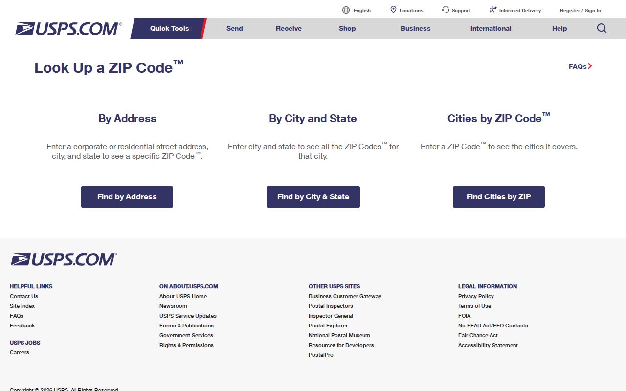
Copy the returned address exactly before moving to Lake County records. That prevents spelling and unit errors from becoming false no-result searches.
USPS is authoritative for delivery format, but it does not answer ownership, occupancy, voter status, or municipal jurisdiction. Those questions belong to the assessor, GIS, election office, and Village. A clean ZIP code directory keeps those handoffs clear instead of treating one postal response as a universal identity result.
Find Vernon Hills Records by ZIP
The assessor accepts ZIP, city, street, township, owner, and parcel fields. That makes it the strongest official starting point for a group of Vernon Hills parcels. The GIS Address Labels layer also contains situs ZIP, city, state, and address lines. Recorder Quick Search has no dedicated ZIP control, so the property address, PIN, subdivision, legal description, or party name must carry the search forward.
- Confirm the exact delivery label with USPS By Address. Save both the five-digit ZIP and any ZIP+4.
- Enter 60061 in the Lake County Basic Property Search. Add Vernon Hills, street, or township criteria to narrow the rows.
- Compare the parcel in the county map service. Note situs ZIP and each district field separately.
- Move from a parcel to the Recorder by PIN, address, subdivision, or party name. Do not expect a ZIP-wide recorder filter.
Once the ZIP search narrows to one road, the Vernon Hills street directory provides the street-level record chain. Voter tools should be used for individual registration verification within their legal limits, not for building an unrestricted ZIP roster.
If a parcel search returns too many rows, add the city and street rather than guessing a second Vernon Hills ZIP. For one known parcel, use its PIN to reach recorded documents. For a broad statistical question, switch to the Census ZCTA and label the result as statistical. Each route begins with 60061, but the result set and legal meaning differ.
Filter Vernon Hills Parcels
The assessor form combines geographic and owner fields, which helps test whether 60061 is too broad for the task. Results are tax records, so label the assessment year and retrieval date. A taxpayer mailing address can differ from the parcel's situs address and does not identify the current occupant.
| Property field | Best use | Caution |
|---|---|---|
| ZIP Code | Collect parcels in 60061 | Postal grouping, not Village boundary |
| City Name | Pair Vernon Hills with ZIP | May reflect a mailing label |
| Street | Narrow the ZIP to a road | Use normalized street spelling |
| Township | Separate tax geography | Township is not postal city |
| Owner or Parcel ID | Reach one tax parcel | Owner is not necessarily occupant |
The county assessor screen displays the city and ZIP controls used for this method.
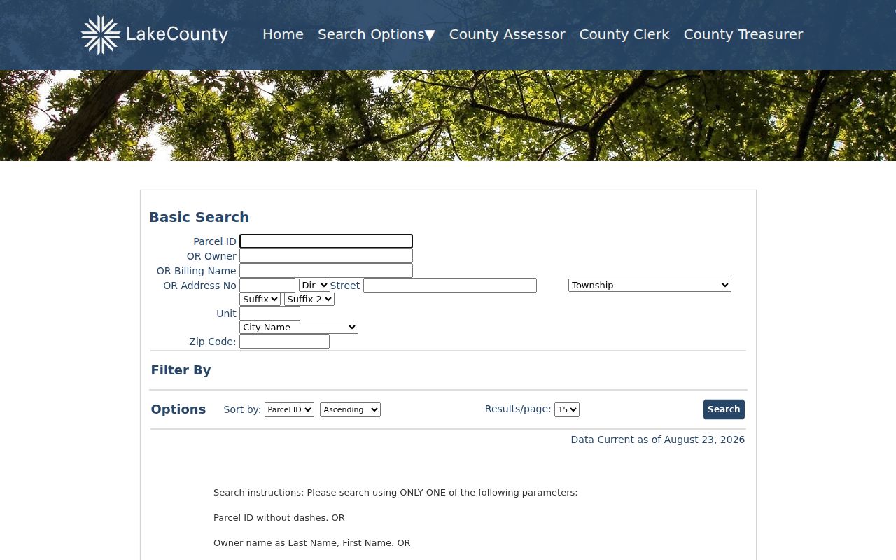
Use the returned parcel ID as the stable handoff to mapping and recorded land documents.
Assessment data are current-year evidence, not an archive of every past resident. Sort and save only the fields needed for the task. If the goal changes from ZIP-wide context to one owner's document trail, move to the Lake County Public Search by parcel ID or party name rather than repeating broad ZIP queries.
Map Vernon Hills ZIP Labels
The Lake County Tax Parcel Viewer map service exposes Address Labels, parcels, subdivisions, roads, survey data, and district layers. Its address fields can compare situs city, state, and ZIP around Vernon Hills. This is useful when a postal label and a district map appear to disagree.
The map service supplies more geographic fields than the Recorder, while recorded documents supply legal history. Neither replaces USPS address validation. The service layer list also shows that one 60061 property can belong to a township, precinct, school district, library district, and tax parcel system at the same time.
The captured county layer screen shows the query-capable GIS structure used for ZIP and district comparisons.
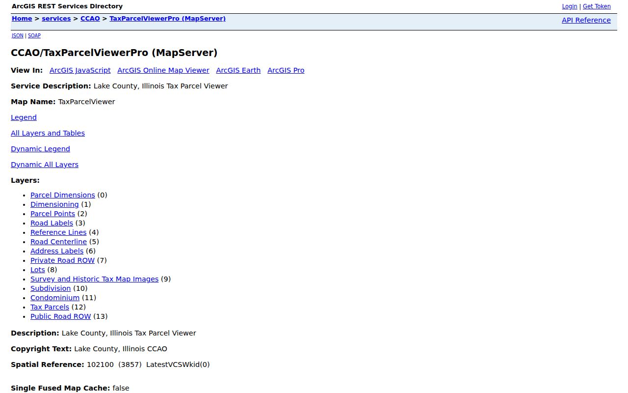
Read each field under its own label rather than forcing all map geographies to match the postal name.
Lake County announced a new Maps Online system in January 2026 and a Tax Parcel Viewer in March 2026. That recent change is another reason to record the access date and layer name. A saved map label can become stale when the county changes services, refreshes parcel facts, or updates district boundaries.
What Vernon Hills ZCTA Measures
Census ZCTA 60061 is a statistical approximation of the postal area, not a USPS delivery boundary. Its 2020 population was 27,581. The 2024 American Community Survey profile reports 11,823 residential units, 11,343 households, median household income of $124,468, and 67.6 percent of residents with a bachelor's degree or higher.
Those figures describe the ZCTA, not the incorporated Village alone. Use Census data for area statistics and USPS for address validity. Mixing them can make a ZIP code directory appear more exact than the source allows. A parcel or resident claim still needs an official record tied to the exact address.
The difference matters in comparisons. Household, education, income, and residential-unit values can describe the 60061 statistical area without matching Village reports. Cite “ZCTA 60061” in notes and tables. Do not silently relabel those numbers as Vernon Hills municipal totals.
Note: A ZCTA total should always carry its year, because it is a dated statistical estimate rather than a live postal count.
Growth Changed Vernon Hills Geography
Vernon Hills incorporated in 1958 after starting as a small subdivision. Later growth over the former Cuneo estate and Hawthorn Mellody Farms created modern roads and subdivisions on an older parcel landscape. The Hawthorn Properties and Cuneo Estate annexation covered about 1,174 acres north of Route 60 between Route 21 and Butterfield Road.
That history explains why postal, legal, and municipal descriptions may not line up cleanly. Annexation documents went to both the Lake County Recorder and Village Clerk. A modern 60061 address can therefore require USPS for delivery form, GIS for current geography, and recorded plats or deeds for its earlier land identity.
The Village history records the community's incorporation and growth.
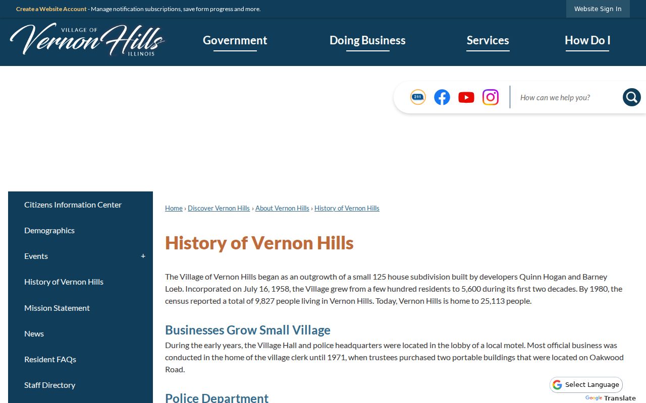
The history gives context to changing place names, but it does not replace a current address check.
Vernon Hills ZIP Versus Village
Postal city, incorporated Village, township, ZCTA, school district, precinct, library district, and county are separate systems. A record can say Vernon Hills because that is the postal city while a GIS layer assigns another local district. Preserve the wording from each source and note its date. Do not turn 60061 into a legal municipal boundary.
A Vernon Hills ZIP code directory should also resist guessed neighboring codes. If an address lies near the Village edge, use USPS By Address first, then compare the county parcel and municipal map. The result verifies delivery format, not the name of a person or organization at that point.
When the systems disagree, keep both labels, identify each source, and ask the proper custodian to confirm its own field.
- ZIP vs ZIP+4
- A five-digit delivery area versus the added four digits that narrow a route or delivery segment.
- PO-box ZIP
- A code assigned mainly to post office box delivery rather than ordinary street delivery.
- Unique ZIP
- A code assigned to one organization or very large mail receiver.
- Carrier route
- The operational group of addresses served by one postal delivery route.